All of Dundas’ Exploration Licences sit in an area of the south-eastern Albany-Fraser Orogen, where considerable uncertainty still exists as to the regional geology. This is primarily a function of the lack of detailed exploration work previously undertaken in the area, combined with the fact that a considerable amount of the underlying bedrock within the licences is covered by a 2m-40m layer of sand and calcrete (regolith, or cover). Historically, the deepest historic drill hole within the Dundas licences to test bedrock was 64m, with most holes 20m-40m, which barely intersected the top of underlying bedrock. As a comparison, the Nova nickel deposit discovery hole was ~190m deep.
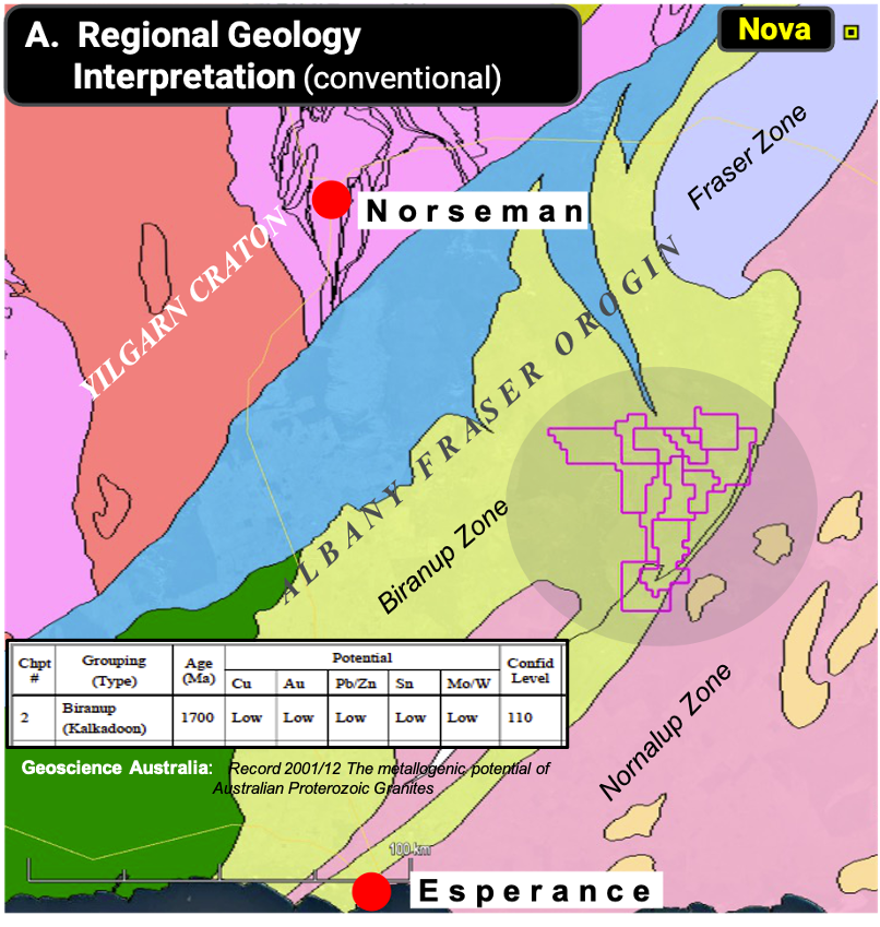
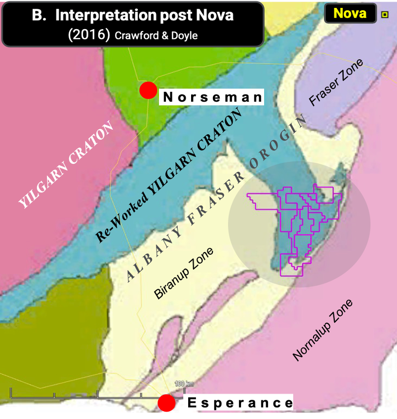
Until quite recently, the area where Dundas’ licences are located has been classified as part of the Albany Fraser Orogen central Biranup Zone and assumed to comprise predominantly gneiss, and Proterozoic magmatic granite, with ages of ~Ma 1,700 (see A below). As recently as 2001, Geoscience Australia published that the Biranup Zone had a low level of prospectivity for minerals such as copper, lead/zinc and gold (but not nickel). This historical view would help to explain the lack of past exploration. However, more recent research largely prompted by the unexpected Nova nickel/copper discovery (2012) in the Albany-Fraser, has resulted in the area of the Dundas licences being classified as Re-Worked Yilgarn Craton (see B below). This fundamentally changes the prospectivity and variety of rock types within Dundas’ licences, it underpins Dundas’ exploration and prospectivity models – and for Dundas to make the next Company Making Discovery in the Albany-Fraser.
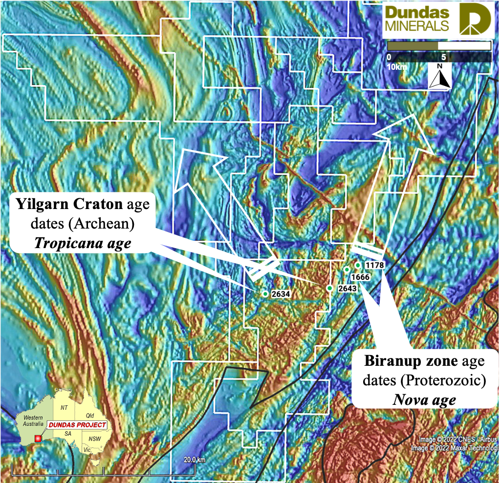
Magnetic Image illustrating rock age dates (GSWA – as available) in Dundas Minerals Exploration Licences